
Upper Moreland Postal ZIP Coverage
Official Township and County address materials verify two postal ZIP examples for Upper Moreland Township: 19090 and 19040. They are delivery-routing examples, not municipal boundary lines. The Township identifies Willow Grove with 19090 in its administrative materials, while County precinct material places some Upper Moreland facilities under Hatboro, 19040. A specific address still needs its own delivery check. USPS indexes postal cities and addresses, not the government unit called Upper Moreland Township.
| ZIP | Areas Covered | Post Office | Notes |
|---|---|---|---|
| 19090 | Willow Grove postal identity used by Township offices, the library, police, and many precinct facilities. | Willow Grove postal identity | Primary Township administrative postal identity in the verified local materials. |
| 19040 | Hatboro postal identity used by Upper Moreland precinct facilities, including Fulmor Heights and Willow Grove YMCA. | Hatboro postal identity | Crosses the municipal line. Hatboro Borough is a separate municipality. |
No other ZIP was verified as serving a Township address during this research. The table is deliberately narrow: it reports what official local address materials establish, not an unverified marketing list. Use the USPS address lookup for the delivery ZIP of a particular property.
Check an Upper Moreland ZIP by Address
USPS is the delivery authority. Its ZIP Code by Address mode calls for a street address plus city and state, or a street address plus ZIP. The same service also offers ZIP Code by City and State, and Cities by ZIP Code. An optional company or apartment field can help distinguish a delivery point. A USPS result does not confirm a person or organization at that address, and USPS advises using the recognized city name for delivery.
The official USPS address lookup presents the delivery-oriented choices used to test a complete address.
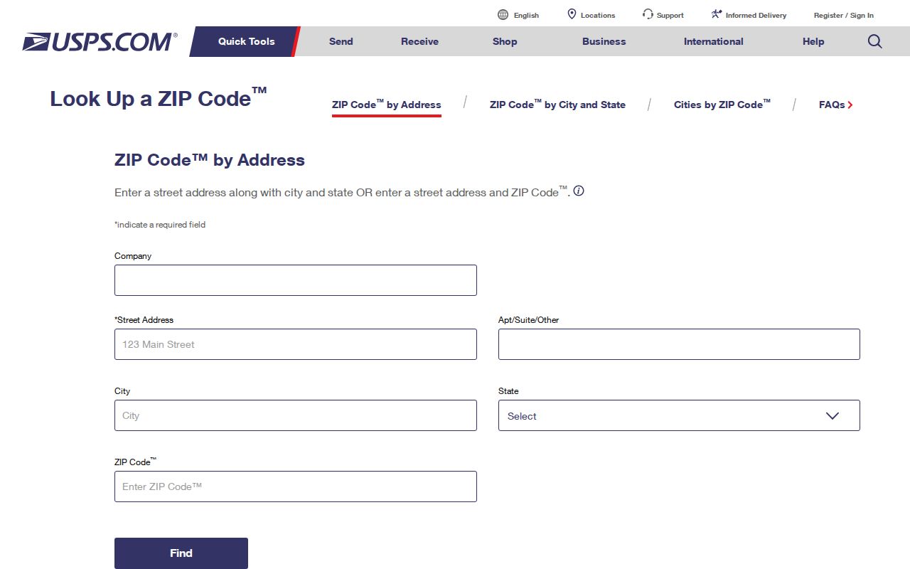
After USPS returns the delivery format, retain that result with the date checked. It settles a mailing question but does not decide whether the address lies inside the Township or identify a current household.
| USPS mode | Useful input | What it answers |
|---|---|---|
| Address mode | Street address plus city/state or a ZIP | The delivery ZIP and recognized mailing city for one address. |
| City/state mode | City and state | A postal-place starting point, not a municipal-boundary result. |
| City-by-ZIP mode | A ZIP | Postal city names associated with that ZIP. |
Upper Moreland Postal ZIPs Are Not County Filters
There is no verified ZIP-wide filter for every County parcel, voter, or map record. Montgomery County Property Records accepts address components, a unit, and municipality. Its Advanced Search includes municipality, street, parcel, sale, and property-characteristic criteria, but not ZIP. The Pennsylvania voter status tool is for an individual’s status, and County GIS has public mapping data without a documented ZIP query control on its landing page.
That limit is useful. It keeps a ZIP code directory from promising a broad roster that the underlying official tools do not supply. Choose UPPER MORELAND in the property system, enter the address or street components, and use USPS only to verify the mailing ZIP for that specific delivery point. Voter information has an individual status route and a controlled written request route, not a Township ZIP search.
| Property Records field | Format | ZIP research use |
|---|---|---|
| Street | Required text, with wildcard support | Find an address sequence, not a ZIP-wide set. |
| Municipality | Optional dropdown | Select UPPER MORELAND to narrow duplicate county street names. |
| Number, direction, suffix, unit | Optional address parts | Refine the exact physical address before a delivery check. |
| Parcel ID | Separate full or partial-number search | Reconnect a confirmed address to County parcel research. |
| Advanced criteria | Property and sale controls | No ZIP criterion was documented. |
Note: A ZIP result is delivery metadata, while the property system is the County path for a parcel and official physical location.
Use a Postal ZIP for an Exact Address
A careful Upper Moreland postal ZIP search moves from delivery routing to the record key that County offices use. This sequence handles the local split between Willow Grove and Hatboro postal labels without treating either label as a municipal finding. It also preserves the facts needed if the first address search does not resolve the question.
- Enter the complete delivery address in USPS and record the returned ZIP and recognized city name.
- Open Montgomery County Property Records and search the address with Municipality set to UPPER MORELAND when appropriate.
- Save the displayed physical location and parcel ID, then distinguish them from any separate mailing line.
- Keep the legal description or plan clue available before moving to deed research through the Recorder.
- Use the Township or County custodian for the particular administrative file, with an address, date range, and record type.
Once the ZIP has narrowed a delivery question to a road, the Upper Moreland streets reference is the better route for address-by-address County research. A postal ZIP itself does not replace the parcel bridge.
Upper Moreland Postal Address Types
Four address terms can look alike while answering different questions. The assessment roll uses a physical property location, and County tax material may also show an owner correspondence line. Recorded deeds depend on the legal description, which can survive a changed street format. The parcel ID connects the physical location to assessment research, tax maps, GIS, and Recorder work.
- Situs or property address
- The official physical location shown in the assessment roll.
- Mailing address
- A correspondence line associated with tax or ownership material. It can be outside Upper Moreland and is not proof of residence.
- Legal description
- The lot, block, subdivision, metes-and-bounds, or recorded wording used in deeds and plans.
- Parcel ID
- The County assessment identifier that links a physical location to its map and property-record path.
- ZIP+4
- An added delivery segment used by USPS to refine routing beyond the five-digit ZIP.
- Carrier route
- A Postal Service delivery grouping, not a Township boundary or a public list of people.
Neither a PO-box ZIP nor a unique institutional ZIP was verified for Upper Moreland Township in this research. Those labels should not be added to an address analysis without an exact USPS result.
Upper Moreland Postal Labels
Willow Grove is the main community and postal identity associated with Upper Moreland, but it does not define the Township line. Hatboro is a separate borough, even though a Hatboro mailing label and 19040 can appear at Upper Moreland precinct facilities. For local orientation, consult the Township’s Streets and Ward Maps, which show roads, wards, parks, municipal edges, and nearby places. They are not postal-boundary maps.
This geography also explains why an address may need separate checks for municipal identity, postal routing, and voting place. A postal city field is not enough to decide which government keeps a record. Property Records and the relevant Township or County office remain the next source after USPS validates the delivery line.
Upper Moreland Postal Boundaries Compared
Several boundary systems meet around Upper Moreland Township. They answer different questions and should not be substituted for one another. A postal label routes mail. A Township boundary identifies local government. A precinct describes election administration. A magisterial district relates to court geography. One address can sit within all four systems at once, with different names or lines attached to each.
| Question | Relevant geography | Best check |
|---|---|---|
| How should mail be addressed? | USPS delivery ZIP and recognized city | USPS address lookup. |
| Is a property in Upper Moreland Township? | Municipal and parcel geography | County Property Records and Township maps. |
| Where does a voter check status or polling place? | Election precinct and voter record | Pennsylvania Check My Voter Registration. |
| Which minor court area may apply? | Magisterial district geography | Montgomery County district boundaries. |
Upper Moreland’s seven wards and split magisterial coverage make this comparison practical, not abstract. Confirm the particular address and the date of the source before assigning it to a current precinct or court area.
Upper Moreland Postal Record Channels
After the exact address and parcel are clear, County and Township access channels become useful for different record types. The Montgomery County Recorder of Deeds Public Access System is name-oriented and can search name, address, and parcel after account access. County records date to 1784, but remote document images require a subscription. Counter computers, mail-copy requests, and the Recorder’s copy process are alternatives when the online path does not supply an image.
Upper Moreland Code Enforcement keeps permit, inspection, property-maintenance, planning, and subdivision files. No public historic address-result index was located. For an existing administrative file, call or seek an appointment, or make a focused Township Right-to-Know request that states the address, date range, and record type. The Right-to-Know route does not override separate court, vital, sealed, or protected-address rules.
Note: Verify the Township’s current physical location before a counter visit because official materials describe a temporary relocation and older references use Park Avenue.
Historic Upper Moreland Postal Context
Postal names are also period evidence. Before 1916, the later Township was part of Moreland Township, so a deed, map, tax list, or directory can correctly use the older jurisdiction name. Upper and Lower Moreland were divided in 1916, and Upper Moreland became first class in 1930. For an early item, preserve its printed municipality and post-office label instead of silently converting it to a modern Township label.
The Township history and its Willow Grove history help distinguish local place identity from postal routing. For old property records, the stronger bridge is usually the parcel, legal description, plan, or party name, rather than a modern postal ZIP.
Limits of the Upper Moreland ZIP Code Directory
A ZIP code directory can verify routing and organize an address question. It cannot establish Township residency, property ownership, household composition, voter status, or an identity at a delivery point. The same limit applies to a mailing line on a County assessment record. Use the named custodian and its specific record for each narrower question.
Boundary reminder. Use ZIP information for delivery and geographic orientation only. Do not use it to monitor, harass, or target anyone, and do not try to infer protected address information from public material.